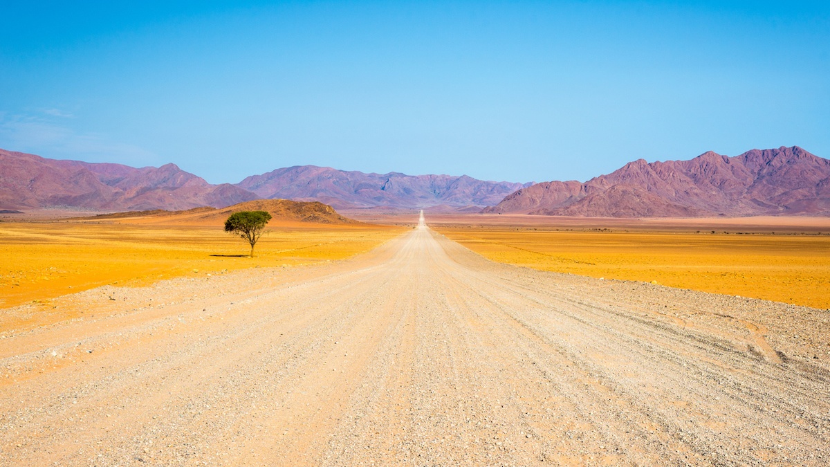
Western Zimbabwe is one of Africa's great self-drive frontiers , a vast, sun-scorched landscape of mopane woodland, granite kopjes, thundering waterfalls, and shimmering inland seas that rewards those willing to get behind the wheel and explore on their own terms. Whether you're cruising the A8 highway between Victoria Falls and Bulawayo with elephants crossing the tarmac ahead of you, navigating the red-dirt tracks of Binga along the Kariba shoreline, or looping through the ancient granite boulders of the Matobo Hills, every kilometre in this corner of Zimbabwe delivers something extraordinary. This guide is your definitive road-trip companion , covering the five best driving routes, fuel stops, road conditions, accommodation at every major stop, and both 7-day and 14-day itinerary frameworks , so you can plan your Western Zimbabwe adventure with confidence and hit the road knowing exactly what lies ahead.
Why Self-Drive Western Zimbabwe?
Self-driving in Western Zimbabwe gives you something no guided tour can fully replicate: complete freedom to stop, linger, and discover. The region spans roughly 150,000 square kilometres , from the spray-drenched gorges of Victoria Falls in the north-west to the fortress-like granite hills of Matobo in the south, and from the Binga lakeshore in the north-east to the border post at Beitbridge in the south-east. That scale demands a vehicle and a plan.
The practical case for self-driving is compelling. Hiring a 4×4 or high-clearance vehicle in Zimbabwe typically costs between $80–$160 USD per day, inclusive of basic insurance, compared to guided safari packages that can run $400–$800 USD per person per day. For families, couples, or small groups, the savings are significant , and the flexibility is priceless. If you're travelling with children, our Victoria Falls with Kids: The Ultimate Family Adventure Guide has excellent advice on pacing a road trip around younger travellers.
Western Zimbabwe's road network is more accessible than many visitors expect. The main A8 and A6 highways are tarred and generally well-maintained, making them suitable for standard saloon cars during the dry season (May–October). Secondary roads , particularly those leading into Hwange National Park, along the Kariba shoreline, and through Chizarira , require a 4×4 with good ground clearance, especially after rains. Before you pack, read our complete Zimbabwe packing list to ensure you have the right gear for the road conditions you'll encounter.
"We did the Victoria Falls to Bulawayo drive in two days and stopped every time something caught our eye , a herd of buffalo near the road, a baobab we wanted to photograph, a roadside village selling mangoes. That spontaneity is impossible on a tour bus."
The best time to road-trip Western Zimbabwe is May through October, when roads are dry, wildlife congregates around waterholes, and temperatures , while warm , are manageable. November through April brings the rains, which transform the landscape into lush green but can render dirt roads impassable. For a detailed seasonal breakdown, see our guide on the best time to visit Victoria Falls month by month. Use our Trip Planner to build a custom itinerary around your travel dates.
Vehicle Requirements: For main highway routes (A8, A6), a standard 2WD saloon is sufficient in dry season. For Hwange's internal tracks, Binga, Chizarira, and Matobo back roads, a 4×4 high-clearance vehicle is strongly recommended year-round. Always carry two spare tyres, a tow rope, jump leads, a first-aid kit, and at least 20 litres of emergency fuel in jerry cans.
Master Distance & Time Table: All Major Stops
Planning a Western Zimbabwe road trip starts with understanding the distances and realistic driving times between key destinations. The table below covers every major stop across all five routes in this guide. Driving times assume daylight hours, average road conditions, and stops at fuel stations , they do not account for wildlife sightings, photography stops, or border crossings, all of which add significant time.
| From | To | Distance (km) | Est. Drive Time | Road Type | 4×4 Required? |
|---|---|---|---|---|---|
| Victoria Falls | Hwange Main Camp | 178 km | 2.5–3 hrs | Tarred (A8) + dirt | Recommended |
| Hwange Main Camp | Bulawayo | 335 km | 4–5 hrs | Tarred (A8) | No |
| Victoria Falls | Bulawayo (direct) | 439 km | 5–6 hrs | Tarred (A8) | No |
| Bulawayo | Matobo Hills (Maleme) | 52 km | 1–1.5 hrs | Tarred + gravel | Recommended |
| Bulawayo | Beitbridge | 323 km | 4–5 hrs | Tarred (A6) | No |
| Bulawayo | Binga | 340 km | 5–6 hrs | Tarred + gravel/dirt | Yes |
| Binga | Chizarira NP (Mabola) | 95 km | 2.5–3.5 hrs | Dirt/4×4 track | Yes (essential) |
| Chizarira NP | Victoria Falls (via Hwange) | 310 km | 5–7 hrs | Dirt + tarred | Yes |
| Victoria Falls | Kazungula Border | 72 km | 1–1.5 hrs | Tarred | No |
| Lupane | Bulawayo | 165 km | 2–2.5 hrs | Tarred (A8) | No |
| Tsholotsho | Hwange Main Camp | 120 km | 2.5–3.5 hrs | Gravel/dirt | Yes |
| Gwanda | Bulawayo | 120 km | 1.5–2 hrs | Tarred | No |
Planning Tip: In Zimbabwe, never plan to drive more than 400 km in a single day on mixed road types. Potholes, livestock on roads, and slow-moving trucks are common, particularly on the A8 south of Lupane. Build buffer time into every driving day , your road trip will be far more enjoyable for it.
Route 1: Victoria Falls to Bulawayo via Hwange National Park
This is the classic Western Zimbabwe road trip , a 439-kilometre journey along the A8 highway that passes through the heart of one of Africa's greatest wildlife sanctuaries. Most travellers complete it as a two- to three-day drive, spending at least one night inside Hwange National Park to experience its legendary waterholes at dawn and dusk.
The route begins in Victoria Falls town, where you should allow at least a full day before departing. The falls themselves are non-negotiable , but beyond the main viewpoints, consider adding a helicopter flight over the gorge, a sunset cruise on the Zambezi, or, for the adventurous, white water rafting through the Batoka Gorge. If you're visiting between September and December, Devil's Pool on Livingstone Island is one of the world's most extraordinary natural swimming experiences.
Leaving Victoria Falls, the A8 heads south-east through mopane scrubland. After approximately 100 km, you'll reach the Hwange National Park boundary near Hwange town. Fuel up here , this is the last reliable fuel stop before Hwange Main Camp. The turn-off to Hwange Main Camp is a further 25 km south, then 10 km on a gravel road into the park. The park's internal tracks reward slow, patient driving: this is prime elephant country, and Hwange's famous waterholes , Dom, Nyamandhlovu Pan, and Masuma Dam , are among the best wildlife-viewing spots on the continent. For those who want to get out of the vehicle entirely, walking safaris in Hwange offer a profoundly different perspective on the bush.
From Hwange, the A8 continues 335 km south-east to Bulawayo, passing through Lupane (a useful fuel and lunch stop, roughly halfway). The road quality varies , sections near Lupane and Tsholotsho junction can be potholed , but the drive is manageable in a standard vehicle. Arriving in Bulawayo, Zimbabwe's second city, gives you a base for exploring the Matobo Hills and the city's remarkable colonial-era architecture. Our Bulawayo City Guide covers 15 unmissable experiences in the City of Kings.
| Stop | Distance from Vic Falls | Fuel Available? | Budget Option (USD/night) | Mid-Range Option (USD/night) | Luxury Option (USD/night) |
|---|---|---|---|---|---|
| Victoria Falls | 0 km | Yes (multiple) | Shoestring Backpackers ($15–25) | Cresta Sprayview ($80–120) | Victoria Falls Hotel ($350–500+) |
| Hwange Town | ~100 km | Yes | Baobab Lodge ($30–45) | Hwange Safari Lodge ($150–200) | Somalisa Camp ($500–700+) |
| Hwange Main Camp | ~135 km | No | ZimParks Chalets ($25–40) | The Hide ($300–400) | Linkwasha Camp ($700–900+) |
| Lupane | ~270 km | Yes | Lupane Motel ($20–35) | Limited options , continue to Bulawayo | , |
| Bulawayo | 439 km | Yes (multiple) | Travellers Guest House ($25–40) | Bulawayo Rainbow Hotel ($70–100) | Nesbitt Castle ($150–220) |
Important: Do not drive inside Hwange National Park after dark. Park gates close at 6:00 pm and open at 6:00 am. Animals , including lions and elephants , frequently cross internal tracks at night, and driving without a guide after dark is both illegal and extremely dangerous. Plan your game drive timing accordingly and always check in with the ZimParks office at Hwange Main Camp on arrival.
Route 2: The Bulawayo to Matobo Hills Loop
The Matobo Hills loop is the most accessible day-trip or overnight road trip from Bulawayo, and arguably one of the most rewarding short drives in all of Southern Africa. The route covers just 100–130 kilometres in a rough loop, yet packs in ancient San rock art, the grave of Cecil John Rhodes, white rhino tracking on foot, and some of the most dramatic granite scenery you will find anywhere on earth.
From central Bulawayo, take the Matobo Road (R34) south for approximately 35 kilometres to the main Matobo National Park entrance at Maleme Dam. The road is tarred to the park boundary and transitions to good gravel inside , a standard vehicle is fine for the main tourist circuit, though a 4×4 opens up the more remote tracks in the Whovi Wilderness Area, where white rhino sightings are almost guaranteed on a guided tracking walk.
The highlights of the Matobo loop are numerous. Nswatugi Cave contains some of Zimbabwe's finest San rock paintings, depicting giraffe, kudu, and human figures in extraordinary detail , some estimated to be over 2,000 years old. World's View (Malindidzimu Hill), where Cecil Rhodes chose his burial site, offers a 360-degree panorama across a sea of balancing boulders that is genuinely breathtaking at sunrise. The Whovi Game Park within Matobo is one of the few places in Zimbabwe where you can reliably see both white and black rhino , the park has one of the highest densities of leopard in Africa, and wildlife photographers consistently rate it among the continent's best locations.
For accommodation, Maleme Rest Camp (ZimParks, from $35/night) sits right inside the park and is a wonderfully atmospheric base. Mid-range travellers favour Big Cave Camp ($150–200/night), built into the granite boulders themselves, while Amalinda Lodge ($300–450/night) represents the luxury tier with extraordinary boulder-integrated architecture. Most visitors combine a Matobo overnight with time in Bulawayo , the city's Natural History Museum, Railway Museum, and Mzilikazi Art Centre make for a rich cultural counterpoint to the wilderness. If budget is a consideration, our guide to experiencing Western Zimbabwe without breaking the bank has practical advice on stretching your dollars further across both destinations.
"Tracking white rhino on foot in Matobo was the single most thrilling hour of our entire Southern Africa trip , and we'd been to Kruger, Etosha, and the Okavango. There's nothing like being on foot, 20 metres from a two-tonne animal, with only your guide between you and it."
Loop Extension: From Matobo, adventurous drivers can extend south to Gwanda (120 km on tarred road) and explore the Tuli Safari Area along the Shashe River , a remote, seldom-visited wilderness that offers excellent birding and the chance to encounter elephant, buffalo, and wild dog with virtually no other tourists present. See our Bird Watching in Western Zimbabwe guide for the top species to look for along this southern corridor.
Route 3: The Lake Kariba Coastal Drive
Lake Kariba's Zimbabwean shoreline is one of Africa's great undiscovered road-trip destinations , a 220-kilometre arc of drowned forests, fishing villages, and wildlife-rich floodplains stretching from Kariba town (accessible from Harare or Makuti) westward to the remote Tonga community town of Binga. This is emphatically a 4×4 route: the road west of Mlibizi deteriorates significantly, and sections after rain can be impassable even for experienced off-road drivers.
The drive rewards those who make the effort with extraordinary scenery. Matusadona National Park, accessible by boat from Kariba or via a rough track from the south, holds large elephant populations that wade and swim between the drowned acacia trees , a surreal and iconic Kariba image. The lake itself, created by the Kariba Dam in 1958–1963, is 282 kilometres long and up to 40 kilometres wide, making it one of the largest man-made lakes in the world by volume. Sunsets over the water, with dead trees silhouetted against an orange sky, are the stuff of photography legend , our 12 Wildlife Photography Tips will help you capture them at their best.
The town of Binga is the cultural heart of the Tonga people, Zimbabwe's most ancient ethnic group, who were displaced from the Zambezi Valley when the dam was built. Today, Binga is a fascinating and genuinely off-the-beaten-track destination , a place where village tours connect you directly with Tonga craft traditions, fishing culture, and oral history. Our dedicated guide to Binga and Lake Kariba as Western Zimbabwe's hidden gem covers everything you need to know about visiting this remarkable corner of the country.
Fuel is a critical planning consideration on this route. Between Mlibizi and Binga (approximately 90 km), there are no formal fuel stations. Carry a minimum of 40 litres of spare fuel in approved jerry cans. Mobile phone signal is intermittent throughout the Kariba shoreline west of Kariba town , download offline maps (Maps.me or OsmAnd cover the area reasonably well) before departing and inform your accommodation of your expected arrival time. For comprehensive preparation advice, visit our Travel Advice section.
Accommodation on the Kariba Coastal Drive: Options range from basic ZimParks camping at Mlibizi ($10–15/night per site) to the mid-range Binga Rest Camp ($40–70/night) and the more comfortable Kulizwe Lodge near Binga ($120–180/night). Advance booking is essential between June and September , this route has a small but dedicated following of repeat visitors who book months ahead. Check our Business Directory for up-to-date contact details for all accommodation providers along the route.
Road Conditions, Fuel Stations & Driving Safety
Understanding road conditions before you set off is arguably the most important part of planning any Western Zimbabwe road trip. The quality of tarmac varies dramatically across the region, and what looks like a straightforward route on Google Maps can turn into a challenging off-road adventure , particularly during the rainy season between November and March.
The A8 highway connecting Victoria Falls to Bulawayo is the most reliable road in the region and is generally well-maintained, though potholes appear seasonally and roadworks can cause delays near Lupane. Budget an extra 30–45 minutes for unexpected slowdowns on this stretch. The roads into Hwange National Park are mostly gravel and require a 4x4 vehicle , do not attempt them in a standard saloon car, especially after rainfall. For a detailed breakdown of which tracks to tackle and when, our Self-Drive Safari in Hwange: Routes, Road Conditions & What You Need to Know guide is essential reading.
Fuel availability is a genuine concern. Always fill your tank at every opportunity rather than waiting until the gauge drops. Key reliable fuel stops include Victoria Falls town, Lupane, Hwange town, and Bulawayo city. Along the Binga route, fuel is scarce , carry a 20-litre jerry can as a precaution.
Speed limits are 120 km/h on open roads and 60 km/h in towns. Police roadblocks are common, particularly on the Bulawayo–Victoria Falls highway. Keep your driver's licence, vehicle registration, and insurance documents readily accessible. If hiring a vehicle, confirm that your rental agreement permits travel on gravel roads before signing.
Road Trip Budget Breakdown: What to Expect
Western Zimbabwe road trips can be tailored to suit almost any budget, from shoestring backpackers to luxury self-drivers. The biggest variables are vehicle hire, accommodation, and park entry fees. Below is a realistic breakdown for two travellers sharing costs over a 7-day self-drive itinerary.
| Expense Category | Budget Option (USD) | Mid-Range Option (USD) | Luxury Option (USD) |
|---|---|---|---|
| Vehicle Hire (7 days, 4x4) | $420–$560 | $700–$980 | $1,200–$1,800 |
| Fuel (approx. 1,200 km) | $120–$150 | $120–$150 | $150–$180 |
| Accommodation (per person, 7 nights) | $140–$210 | $350–$560 | $1,050–$2,100 |
| National Park Entry Fees (Hwange + Matobo) | $70–$90 | $70–$90 | $70–$90 |
| Food & Drink (per person) | $70–$105 | $140–$210 | $280–$420 |
| Activities (per person) | $50–$100 | $150–$300 | $400–$800 |
| Total Per Person (shared costs) | $435–$608 | $765–$1,145 | $1,575–$2,695 |
Park entry fees for Hwange National Park are currently $15 USD per person per day for international visitors, with vehicle fees of $5–$10 depending on size. Matobo Hills entry is approximately $10 per person. These fees are subject to change , always verify current rates with Zimbabwe Parks & Wildlife Management Authority before travel.
For travellers watching their spending closely, our guide to Zimbabwe on a Budget: How to Experience Western Zimbabwe Without Breaking the Bank offers practical strategies for cutting costs without sacrificing the experience. Camping inside Hwange, self-catering where possible, and travelling during the shoulder season (April–May or September) all make a meaningful difference.
Essential Packing List for a Western Zimbabwe Road Trip
Packing correctly for a self-drive through Western Zimbabwe is the difference between a seamless adventure and a stressful ordeal. The region's climate, road conditions, and remote locations demand thoughtful preparation. Our comprehensive What to Pack for a Zimbabwe Safari & Victoria Falls: The Complete Packing List covers every detail, but the table below summarises the essentials specific to a road trip format.
| Category | Essential Items | Notes |
|---|---|---|
| Vehicle & Navigation | Offline maps, spare tyre (x2 ideally), tyre repair kit, jump leads, tow rope | Confirm spare tyre is included with hire vehicle |
| Fuel & Fluids | 20-litre jerry can, engine oil, coolant | Essential for Binga and Chizarira routes |
| Clothing | Neutral-coloured layers, wide-brim hat, waterproof jacket, sturdy walking shoes | Avoid blue and black , attract tsetse flies |
| Health & Safety | Malaria prophylaxis, insect repellent (DEET 50%+), first aid kit, oral rehydration sachets | Malaria risk is real in Hwange and Binga |
| Food & Water | Minimum 3 litres water per person per day, non-perishable snacks, portable cooler box | Potable water scarce on remote routes |
| Photography | Camera with zoom lens (300mm+), bean bag for vehicle window, extra memory cards | See our 12 Wildlife Photography Tips guide |
| Documents | Passport, driver's licence, vehicle insurance, KAZA UniVisa (if applicable), printed accommodation bookings | Keep physical copies separate from originals |
| Connectivity | Local SIM card (Econet recommended), power bank, 12V car charger | Signal is limited between Hwange and Binga |
If you are travelling with younger family members, the logistics shift considerably , car seats, sun protection, and activity suitability all require extra thought. Our Victoria Falls with Kids: The Ultimate Family Adventure Guide addresses these specifics in full.
Best Time of Year for a Western Zimbabwe Road Trip
Timing your road trip correctly has an outsized impact on both enjoyment and practicality. Western Zimbabwe has two distinct seasons: a dry season (April to October) and a wet season (November to March). Each offers a genuinely different experience, and neither is universally "wrong" , it depends entirely on your priorities.
The dry season, particularly July to October, is peak wildlife viewing time. Vegetation thins, animals congregate around waterholes, and the roads are at their most reliable. If watching elephants at Hwange's famous waterholes is your primary goal, aim for August or September. Temperatures are warm but manageable during the day, though nights can drop sharply , pack a fleece even in September.
October is the hottest month, with temperatures regularly exceeding 40°C. It is also when the Victoria Falls water levels are at their lowest, though this actually allows access to Devil's Pool on the Zambian side. For a full month-by-month breakdown of water levels and weather patterns, our guide to the Best Time to Visit Victoria Falls is the definitive resource.
The wet season brings dramatic thunderstorms, lush green landscapes, and significantly fewer tourists. The falls are at their most thunderous from February to May, and birdwatching reaches its peak , migratory species arrive in abundance. For birding enthusiasts, our guide to Bird Watching in Western Zimbabwe: Top 8 Spots and 50 Must-See Species is worth reading before you go. The trade-off is that some gravel roads become impassable, and wildlife is harder to spot in dense vegetation.
🐘 Wildlife viewing: August–October
💧 Victoria Falls at peak flow: March–May
🐦 Birdwatching: November–February
💰 Best value rates: January–March (low season discounts of 20–40% common)
The shoulder months of April–May and September offer the best of both worlds: reasonable road conditions, good wildlife activity, comfortable temperatures, and moderate tourist numbers. If you have flexibility, late September is arguably the single best time for a Western Zimbabwe road trip.
Final Thoughts
A self-drive road trip through Western Zimbabwe is one of southern Africa's most rewarding and underrated adventures. From the spray-drenched drama of Victoria Falls to the ancient granite boulders of Matobo Hills, the elephant-packed plains of Hwange National Park, and the remote tranquillity of Binga on Lake Kariba's shores, this region rewards those willing to get behind the wheel and explore at their own pace.
The freedom of self-driving , stopping when an elephant crosses the road, lingering at a waterhole until golden hour, taking the detour that wasn't in the plan , is something no guided tour can replicate. With the right preparation, a reliable vehicle, and a flexible mindset, Western Zimbabwe will exceed every expectation.
Ready to start planning? Use our Trip Planner to build your personalised itinerary, browse our Business Directory for vetted accommodation and vehicle hire operators, or visit our Travel Advice page for the latest entry requirements and safety updates. If you have specific questions, our team is always happy to help , Contact Us directly.
Whether you have 7 days or 14, whether you're a first-time visitor or returning for a deeper look, Western Zimbabwe has a road trip waiting for you. The only question is when you'll go.
Frequently Asked Questions
Do I need a 4x4 vehicle for a Western Zimbabwe road trip?
For routes that include Hwange National Park's internal tracks, the Binga road, or Chizarira National Park, a 4x4 is essential , particularly during or after the rainy season. The main A8 highway between Victoria Falls and Bulawayo can be driven in a standard saloon car, but a high-clearance vehicle is recommended even on tarmac routes due to potholes and occasional flooding near bridges.
How far is it from Victoria Falls to Bulawayo by road?
The direct distance from Victoria Falls to Bulawayo via the A8 highway is approximately 440 kilometres, taking around 4.5 to 5.5 hours of driving time without stops. If you detour through Hwange National Park, the journey extends to roughly 500–520 kilometres and should be spread across two days to allow time for wildlife viewing and to avoid driving after dark.
Is it safe to self-drive in Western Zimbabwe?
Yes, Western Zimbabwe is considered safe for self-drive travel, provided you follow standard precautions. These include never driving after dark due to wildlife on roads, being alert at police roadblocks, keeping documents accessible, and carrying sufficient water and fuel on remote routes. Petty theft can occur in towns , keep valuables out of sight. Most travellers complete self-drive itineraries without incident.
What currency should I carry for a road trip in Western Zimbabwe?
US dollars are the most widely accepted currency for tourists throughout Western Zimbabwe. National park fees, most lodges, and activity operators price in USD. Zimbabwe Gold (ZiG), the local currency, is useful for local markets, roadside stalls, and some fuel stations. Carry a mix of small USD notes ($1, $5, $10) as change can be difficult to obtain. Card payments are accepted in larger towns but unreliable elsewhere.
How many days do I need for a Victoria Falls to Bulawayo road trip?
A minimum of 3 days is needed to drive the Victoria Falls to Bulawayo route with a single overnight stop in Hwange. However, 5–7 days is strongly recommended to spend meaningful time in Hwange National Park and explore the Matobo Hills properly upon arriving in Bulawayo. Rushing this route means missing the wildlife experiences that make it one of Africa's great self-drive journeys.
Are there ATMs and mobile data coverage along the route?
ATMs are available in Victoria Falls town, Hwange town, and Bulawayo city, but they frequently run out of cash or are out of service , withdraw sufficient funds before leaving each major town. Mobile data coverage (Econet is the most reliable network) is generally available along the A8 highway but drops significantly between Hwange and Binga and inside national park areas. Download offline maps and any essential documents before departing.